Feature image credit: ESA
Nicolaus Copernicus was a Renaissance polymath who argued against the ancient Greek vision of the earth as the still centre of the universe, and professed instead that the earth and all the planets orbit the sun. As humans turned their gaze outwards towards our sun and thence towards more distant stars, Copernicus’ work sparked a paradigm shift called the Copernican Revolution.
Centuries later, the Copernicus earth observation programme is a constellation of satellites and a host of in-situ sensors on land, in our oceans and in the air. The planet is now wreathed in a net of Copernican eyes, including a flight of satellites named the Sentinels and additional satellites owned by contributing nations. Data from satellites is verified and supplemented by weather stations and by sensors anchored to riverbanks, tethered to ships, moored to buoys and borne aloft on balloons. The Copernicus Services process and analyse this wealth of satellite and in-situ data, as well as making data collected over decades comparable and searchable.
Like its namesake, this modern Copernicus is a polymath, collecting data on the earth’s atmosphere, its oceans, its lands, its disasters and the security of its populations, and its changing climate. Copernicus provides governments, policy makers, business, industry and citizens with free access to environmental and climate data. By providing accurate, timely data Copernicus hopes to spark a sea change in the way decision makers observe, predict and influence the earth’s climate provided by six Copernicus services.
Copernicus’ maritime monitoring service answers questions including, What patterns do ocean winds follow? Are ocean currents changing? Is sea ice shifting? How salty is the sea, and how polluted? Are sea levels rising? Are coasts eroding?
Copernicus’ land monitoring service asks, How much of the earth is covered by plants? How much is dedicated to agriculture or to forests? How much is grassland or wetland? How much area is covered by paved roads or cities? What is the surface temperature of the earth? How much land do lakes cover? How much water is stored in the soil?
Copernicus’ emergency management service asks, Are our coastlines in danger of flooding? What fires are burning out of control? Where will the next drought occur? The next famine? Where do vulnerable populations live? Can they be evacuated? Is there enough drinking water? Copernicus provides detailed maps based on satellite imagery and flood forecasts. This information supports governments and policy makers seeking to prevent, prepare for, predict, respond to and recover from natural disasters and humanitarian crises.
Copernicus’ security service monitors land and maritime borders. Improved security will reduce the number of immigrants entering the European Union undetected, reduce the death toll of immigrants by rescuing those endangered at sea, and prevent crime from crossing borders.


The Copernicus Atmosphere Monitoring Service (CAMS) measures and forecasts the composition of the atmosphere, air quality, ozone concentrations, solar radiation, and emissions. The service answers questions such as What kind of air will the inhabitants of northern-, eastern-, southern- or western Europe breathe today? How long will this volcanic eruption impact air traffic? How much radiation from the sun will reach my solar panel farm tomorrow? Data about the atmosphere plays a crucial role both in forecasting extreme weather and in studies of climate change.
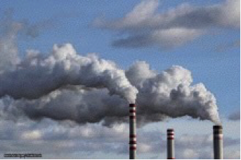
The composition of the atmosphere is affected by emissions from industry and transportation, dust plumes in the desert, ash plumes and pollutants spewed from volcanoes, and smoke from wildfires. Dust, sand, smoke and volcanic ash affect rainfall, transport systems, power grids, and satellite observations.
Air quality is the quality of the air that human populations breathe at the surface of the earth. Industrial emissions, burning fossil fuels, dust, sand and smoke affect the quality of the air. Air quality is a significant risk factor for respiratory disease, impacting human health and life expectancy.
The ozone layer protects life on earth from harmful ultraviolet radiation. Human activities including the emission of organic compounds called chlorofluorocarbons have destroyed part of the ozone layer over Antarctica, increasing human exposure to ultraviolet radiation. CAMS maintains and updates the record of stratospheric ozone and provides forecasts of ozone concentrations and ultraviolet radiation at the earth’s surface.
Clouds, aerosols, water vapour and ozone affect the absorption or scattering of solar radiation in the earth’s atmosphere, determining how much radiation is absorbed far above the earth and how much reaches the surface. CAMS provides the solar energy industry with information about the solar radiation available at the earth’s surface.
Emissions of pollutants by industry and transportation reduce air quality, levels of greenhouse gases in the atmosphere are affected by plant cover, wildfires release pollutants, and wetlands release methane. CAMS inventories emissions and uses its findings to determine the composition of the atmosphere.
Human activity drives climate change by releasing greenhouse gases and aerosols, which affect how much solar radiation is absorbed by the atmosphere or transmitted to the earth’s surface. CAMS monitors the impact of greenhouse gases and aerosols on our changing climate.
The Copernicus Climate Change Service (C3S) utilises Copernicus’ cutting edge satellite and in-situ data as well as a century of instrumental records to monitor the earth’s climate, analyse the data based on a variety of climate change projections, and make climate predictions. C3S provides records of temperatures, rainfall, and drought; accounts of rising temperatures, rising seas, and dwindling ice sheets. C3S will monitor climate change as it occurs and predict its future effects. Better information will help policy makers to prepare for, respond, and adapt to the effects of climate change and facilitate the use of renewable resources in order to minimize the impact of climate change in the future.
The European Centre for Medium-Range Weather Forecasts (ECMWF) is an international research institute which specialises in numerical weather prediction. It is based in Reading, in the United Kingdom, where it hosts one of the largest supercomputer facilities in Europe and the largest meteorological data archive in the world. ECMWF is operating CAMS and C3S on behalf of the European Union. Informed by its work to provide early warning of severe weather events, including wind storms, heat waves, flood and drought, ECMWF is also involved in Copernicus’ marine monitoring and emergency services and runs the computational centre for the European Flood Awareness System.
Copernicus’s data is intended for use by policy makers and public authorities, but anyone may access it at no cost. You must register to access the data, but registration is free. The maps produced to aid response to natural and humanitarian disasters are also available.
Where once Nicolaus Copernicus suggested humans look outwards from the earth, the Copernicus earth observation programme now turns the human gaze back onto our own planet. As Nicolaus Copernicus created his theory that the earth and all the planets orbit the sun, humans were earthbound. We now have eyes in space, and the planet is wreathed in the network of datataking sensors that compose the Copernicus earth observation programme. From space, from our rising seas and from our voracious deserts, Copernicus seeks to direct our attention to the need to understand our tempestuous and changing climate.


Share